- About
- Program
- Registration
- Experience
- Student & EC
- Hotel/Travel
- Sponsor/Exhibit
- Resources & More
CERF 2021 Workshop
|
||||||||||||||||||||||||||||||
| Mark Finkbeiner | |
|
|
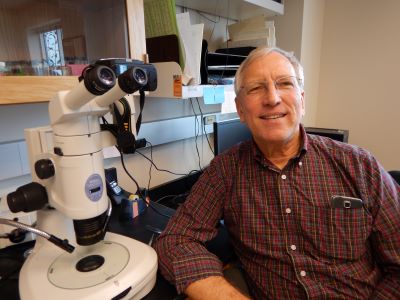
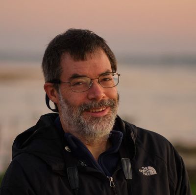
Physical Scientist Mark Finkbeiner leads OCM’s Ocean Data and Tools project, which focuses on supporting the coastal and marine planning community in a wide range of issue areas. Major activities in this project include the Marine Cadastre, the OceanReports Tool, supporting the Coastal and Marine Ecological Classification Standard (CMECS), and other marine mapping and data development efforts. Mark serves on steering committees for several seagrass Communities of Practice and working groups related to marine habitat. Mark has over 25 year of experience in remote sensing, GIS, and benthic mapping. His background includes work in wetland delineation, wellhead protection, land cover change detection, image analysis, and remote sensing training. |
| Robert Orth, PhD | |
 |
Robert Orth is a Professor Emeritus at the Virginia Institute of Marine Science (VIMS), College of William and Mary. Dr. Orth received a BS degree from Rutgers University, a MS degree from the University of Virginia, and a PhD. from the University of Maryland. Dr. Orth has been conducting research on seagrass in the Chesapeake Bay since 1969, and was the team leader of the VIMS Seagrass Monitoring and Restoration Program until 2020. |
| Lawrence R. Handley | |
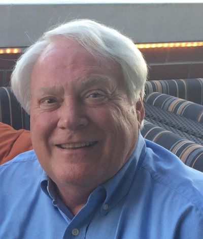 |
Lawrence R. Handley, Scientist Emeritus, USGS specializes in wetland, upland, and seagrass classification, interpretation, and mapping, and natural resource evaluation. His experience and expertise include many facets of environmental assessment and wetland interpretation, especially mapping and surveying for land cover and landscape analysis projects. Mr. Handley retired from US Geological Survey and US Fish and Wildlife Service after a 38-year career. From co-editor of the 2007 Seagrass Status and Trends report for the Northern Gulf of Mexico, Mr. Handley continues his involvement with seagrass assessment and monitoring as a Scientist Emeritus for USGS and consultant with CNL World, most recently as co-developer of the 2020 Seagrass Status and Trends in the Gulf of Mexico update. |
| Catherine M. Lockwood, PhD | |
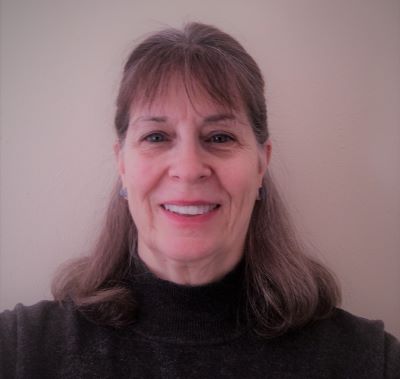 |
Catherine M. Lockwood received a BA from Bemidji State University, a MS from South Dakota State University, and a PhD from the University of Minnesota. She was a Professor of Geography for 18 years, the editor of a professional geography journal for six years, and currently is the Director of Program Development for CNL World, a science, technology, and professional outreach environmental non-profit organization. Dr. Lockwood develops program content, directs research activities, and coordinates field operations. She specializes in cultural ecology and land use assessment and analysis. Dr. Lockwood’s current focus is on watershed and wetland assessments, most recently as co-developer of the 2020 Seagrass Status and Trends in the Gulf of Mexico update. |
| Jud Kenworthy, PhD | |
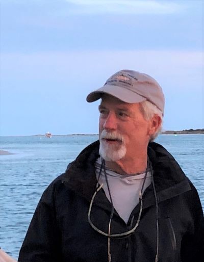 |
Employment: Retired from US National Oceanic and Atmospheric Administration (NOAA) in 2011 Current Voluntary Professional Activities: Serving on the Albemarle Pamlico National Estuary Partnership (APNEP) Scientific Technical Advisory Committee and Team Lead for the APNEP SAV Monitoring and Assessment Team. Also presently serving on the North Carolina Nutrient Criteria Development Scientific Advisory Committee Current Academic Appointment: Adjunct Faculty, Department of Biology and Marine Biology, University of North Carolina Wilmington, Wilmington, NC Primary Focus Area: Coastal and estuarine ecology with emphasis on the ecology, restoration, and management of seagrass ecosystems. Some Career Experiences: Research Team Leader and Principal Investigator leading basic and applied research in coastal and estuarine ecology for NOAA throughout the United States, Caribbean Basin, Mediterranean Sea, Southeast Asia, and Bermuda. Provided scientific expertise supporting NOAA’s mission to conserve, protect and restore coastal marine ecosystems. Since retiring from NOAA I have worked as an expert scientific consultant and advisor in several programs. Including for example; 1) NOAA’s response to the Deepwater Horizon oil spill; 2) the Massachusetts Department of Environmental Protection’s program on coastal ecosystem conservation and restoration, 3) NOAA’s assessment of the interaction between shellfish aquaculture and submerged aquatic vegetation, 4) External advisor to the Piscatagua Region Estuaries Partnership National Estuary Program, 5) Co-chair of the Albemarle Pamlico National Estuary Program’s Scientific and Technical Advisory Committee, and 6) recently served as Co-PI on a North Carolina Coastal Recreational Fishing License Fund project titled “Development of SAV Sentinel Sites in Southeastern NC: Linking SAV Health and Resilience to Environmental Drivers” |
| David J. Wilcox | |
 |
GIS Project Manager David Wilcox helps manage and provides GIS and programming support for the annual Chesapeake Bay SAV aerial monitoring program at the Virginia Institute of Marine Science, College of William & Mary. Dave received his Master’s in Geography from the Ohio State University, and has more than two decades of SAV mapping experience. |
Announcements
SAVE THE DATE
Join Us in Richmond, Virginia, USA
9–13 November 2025
Our Sponsors
@CERFScience
View this profile on Instagram